Main content

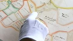
Thomas Raven's Plantation Maps
Nick Crane visits Strangford Lough in County Down and finds out how the enterprising Thomas Raven mapped land in Ulster during the 17th Century. (Broadcast: 24th Oct 2005)
Duration:
This clip is from

More clips from Thomas Raven's Clandeboye Estate Maps (1625)
-
![]()
James Hamilton's Land Maps
Duration: 03:55
-
![]()
Plantation Map - Ringhaddy
Duration: 01:52
-
![]()
The Clandeboye Maps of Thomas Raven
Duration: 01:40